


Cusco · Sacred Valley · the citadel above the clouds · 13.16°S 72.54°W
The old mountain, Machu Picchu — read like a quipu.
Not a single ruin but a whole ascent — acclimatize in Cusco, drift down the Río Urubamba through Ollantaytambo and Písac, then climb the dry-stone terraces to the Intihuatana at 2,430 m.
Where to point the camera, and your feet

Photos: Denisse Leon, Joe Green & Guiville / Unsplash
Three knots in the cord, tied in this order
- 01
Land soft, then lock the ticket
Give Cusco two nights — or drop straight to the lower Sacred Valley — before you climb higher. Then secure the timed-entry ticket and circuit: it's the slot everything else is built around.
- Hydrate; go easy on alcohol day one
- Pick your circuit, then your slot
- 02
Book the train, or the trek permit
No road reaches the site. It's PeruRail / IncaRail from Ollantaytambo, or you walk in — the classic Inca Trail permit cap is gone months out. Salkantay needs no permit.
- Dry season (May–Sep) sells out weeks ahead
- Inca Trail closes every February
- 03
Add the climbs you want
Huayna Picchu and Machu Picchu Mountain are separate add-on permits, each tied to a circuit. Decide early — the peak permits sell out earliest of all, and never at the gate.
- First bus up ~05:30 from town
- Carry your passport — it's stamped
By the part of the journey you're sorting out
Planning & Tickets
The official timed-entry system — which of the three circuits and ten routes sees the terraces, the Temple of the Sun, or the Inca Bridge.
 Circuits explainedCompare the three official circuits and ten routes — panoramic, classic and royal — so you book the right experience: the postcard view, the temples, or the add-on peaks.
 Entry rulesBag size, food, tripods, walking sticks, re-entry, one-way routes and the behaviour that keeps you inside the gate — the practical rules to verify before you go.
 Best circuitThere is no single best circuit — only the right one for you. How to choose by the classic view, photography, ruins depth, hiking ambition, mobility, family pace and ticket scarcity.
Getting There
No road reaches the citadel. PeruRail vs IncaRail, the trek alternatives, and the bus up from Aguas Calientes.
 TrainsPeruRail vs IncaRail, Cusco vs Ollantaytambo departures, the service classes, stations, the strict luggage allowance, bimodal road-and-rail options, and where the train fits in the booking order.
 PeruRail vs Inca RailA decision guide comparing the two operators on the Machu Picchu line — train classes, stations, luggage, schedules, and who each one suits.
 Ollantaytambo → Machu PicchuWhy Ollantaytambo is the most reliable rail gateway to the citadel — the timing, the short gorge ride, where to stay, taxis to the platform, and how to stage it from the Sacred Valley.
Cusco Base
The Inca capital at 3,399 m, where you acclimatize before climbing anything — coca tea, the Coricancha, and where to sleep at altitude.
 Acclimatization & altitudeHow to land soft in Cusco at 3,399 m: reading soroche, pacing your first day, what to eat and drink, the easy activities that help, and when to simply rest before Machu Picchu.
 Where to stay in CuscoA neighbourhood-by-neighbourhood guide to basing in Cusco before Machu Picchu — weighing altitude comfort, charm, walkability, station and airport access, and which area suits families, couples, luxury and budget travellers.
 Costs & budgetA realistic way to think about the money — the fixed citadel ticket, the train that dominates the budget, buses, guides, food and the trek add-ons — and where the costs hide.
Sacred Valley
Ollantaytambo, Písac and the Maras–Moray salt and terrace sites — the lower, gentler valley where most trips stage.
 Valley → Machu PicchuHow to stage Machu Picchu from the Sacred Valley instead of returning to Cusco — why Ollantaytambo is the gateway, how the train and bus connect, and the timing, luggage and altitude logic that make it the smoother way in.Where to stay (Ollanta)The best places to sleep in Ollantaytambo before Machu Picchu — chosen for early-train access, ruins views, luggage storage, budget value and a calm one-night staging stop in a living Inca town.
 Best valley hotelsA curated shortlist of where to sleep in the Sacred Valley before Machu Picchu — sorted by what each does best: shortest train day, gardens and acclimatization comfort, family space, honeymoon luxury and value.
Around the Site
Reading the citadel — the Guardhouse overlook, the Intihuatana, the Temple of the Sun and the Sun Gate, circuit by circuit.
 Where to stay in Aguas CalientesHow to choose a base in the little town below Machu Picchu — weighed not on stars but on how cleanly it gets you onto the first bus, off a late train, fed early, and settled for an altitude-friendly night before the citadel.
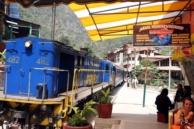 Aguas CalientesAguas Calientes — officially Machu Picchu Pueblo — the cloud-forest town at the foot of the citadel. Where to sleep, how the trains and buses connect, the food, the hot springs, luggage, and how long to stay for a calmer entry.
 Best hotels in Aguas CalientesHow to choose well among the hotels of the town below Machu Picchu — judged not on stars alone but on bus-queue and station proximity, river views, family fit, early breakfasts, luxury and value, and how cleanly each one sets up the citadel morning.
Treks
Walking in instead of riding the rails — the classic Inca Trail and its permit, plus the Salkantay and Lares alternatives.
 Inca Trail vs SalkantayA clear head-to-head between the two classic treks to Machu Picchu — permits and availability, scenery, altitude, cost, comfort and archaeology — to help you pick the right one.
 Inca Trail packingExactly what to bring for the classic four-day Inca Trail — the layering system, rain gear, the sleeping setup, your daypack contents, medication and toiletries, and how the porter duffel weight limit shapes everything.
 MP AlternativesChoquequirao, Kuélap, Huchuy Qosqo and Peru's lesser-visited archaeology — where to find Inca and pre-Inca ruins without the timed tickets and the crowds.
Itineraries
Ready-made routes that knot the trip together — from a tight two days to an unhurried week with the altitude ladder built in.
 Three days: Cusco, Valley & MPA tight but generous three-day route through Cusco, a Sacred Valley or Ollantaytambo staging day, an overnight in Aguas Calientes and the citadel — paced so you sleep low before you climb, with the altitude ladder and timed-entry ticket built in.
 Trekking itineraryHow to structure a trek to Machu Picchu — Cusco arrival, acclimatization days, the trail itself, the citadel entry at the end, and post-trek recovery — for the Inca Trail, Salkantay or Lares.
 Rainy season itineraryA flexible November-to-March plan for visiting Machu Picchu in the wet season — built around weather buffers, train and landslide caution, indoor Cusco time, and the day-by-day rhythm that turns grey skies into an advantage rather than a gamble.
When to Go
Two Andean seasons, not four — dry-season clarity (May–Sep), the June–July peak and Inti Raymi, and the wet-season trade-offs.
 By monthA month-by-month map of Machu Picchu — weather, ticket demand, train and landslide risk, Inca Trail timing and what to book — so you can pick the month that fits the trip you want.
 DecemberWet-season rain meets holiday demand: Cusco's Santurantikuy market, Christmas and New Year crowds, and the flexible train-and-hotel planning a December trip needs.
 Accessible travelAn honest look at mobility at the citadel — the uneven Inca stone, the stairs, how the train and shuttle bus help, hotel strategy, the gentlest circuit and route, and why a private guide is the key to a workable visit.
The Inca wrote in knots
The Inca state ran without an alphabet. Accountants called khipukamayuq kept its records on the quipu (Quechua khipu, “knot”) — a primary cord hung with coloured, knotted pendant strings. The type and position of each knot encoded a number; colour and ply carried category.
Census, tribute, storehouse tallies, even calendars — an empire spanning the Andes, audited in cotton and wool. It is the perfect emblem for a planning guide, and it runs through this whole site: the divider, the hero ledger, and the mark in the tab are all knotted cords.
◷ The Inca origin
In the founding legend recorded by Spanish chroniclers, the ancestor Manco Cápac set out from Lake Titicaca with a golden staff, told to settle where it sank fully into the ground. It vanished at the hill of Huanacauri — and there the Inca founded Cusco, the “navel” from which four roads ran. Machu Picchu sat near the end of one such road, in the warm gorge feeding the cold highland capital.
⚑ Real, not invented
The tricolour across this guide is drawn from three true things: ichu-grass gold, the pale dry-season bunchgrass on the terraces; cloud-forest teal, the wet montane forest of the Urubamba gorge; and cochineal carmine, the Andean dye of highland weavings — not terracotta brick.
Festivals worth timing the trip around
24 JUN · CUSCO
Inti Raymi
The Festival of the Sun re-enacted at Sacsayhuamán — the Inca winter-solstice rite to Inti, the dry season's headline event.
On the calendar15–18 JUL · PAUCARTAMBO
Virgen del Carmen
Masked dancers fill the highland streets for four days around 16 July — one of Peru's most vivid Andean-Catholic fiestas.
On the calendarFEB · INCA TRAIL
Trail closure
The classic Inca Trail closes the whole of February for maintenance and the heart of the rains — plan trains, not treks. The citadel itself stays open.
On the calendar